Crater Lake is the purest blue lake I have ever seen. Every trail we hiked gave us another prospective of the masterpiece. It was a view that didn’t get old. It was like staring at the ocean, gazing at the Milky Way, or being mesmerized by a bonfire. Even a forest fire added to the drama of the scene.
The crater which defines the shoreline is actually a caldera formed by the collapse of an ancient volcano, Mt. Mazama. The lake keeps full from precipitation and snowmelt. Storms originating from the Pacific Ocean drop an average of 43 feet of snow annually. The moisture that falls fills the lake every year, but the level remains consistent because of a ‘leaky’ spot in the caldera rim that allows for the excess water to seep out though the porous ground. The melt water free of sediment and impurity makes the lake ultra clear (Secchci depth of up to 144 feet*). The steep walls of the caldera drop sharply to a maximum depth of 1,943 feet making it the deepest lake in the United States. Water clarity and immense depth are the conditions responsible for the unmatched dramatic blue color on a sunshine day.
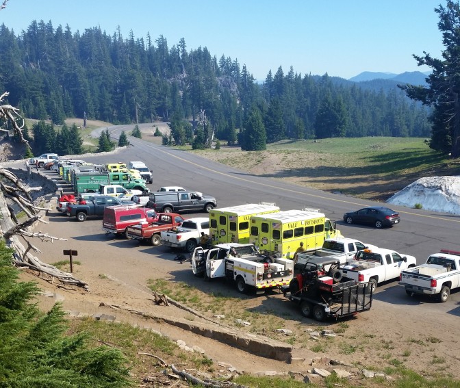
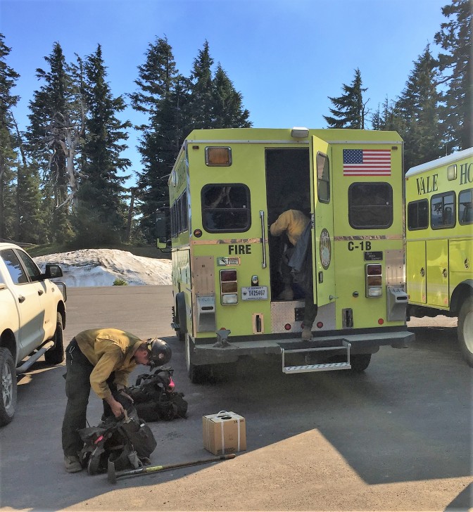
We arrived at the park at the end of July just after a small fire had just broken out on the west side of the lake. It started because a through hiker on the Pacific Crest Trail left a campsite without extinguishing their fire. Because of the dry and windy conditions, the fire grew rapidly. During our stay fire fighters from Oregon and surrounding states battled the blaze during the day.
In the mornings, it appeared as though they were winning the battle. But, each evening the smoke proved differently.
The smoke billowed into the sky and drifted over the lake.

Helicopters flew over out campsite every 10 minutes starting at dawn and continuing until the sun went down, leaving a misty trail in the sky from the buckets of water targeted to douse the blaze. After dropping their payload they would return to the reservoir outside the park to refill for another run.

In between the helicopter sorties, planes would taking turns to dive bomb the fire with chemicals.
While the fire fighter battled the blaze we hiked. Our 1st hike was to Discovery Point, a two mile round trip along the rim, to observe the progress of the fire fighters.

Later, we hiked to Garfield peak, a 3.6 mile climb up and down 1000 feet to the summit just outside of the Rim Village.

We also hiked to the summit of Mount Scott, the highest point in the park at 8,929 feet.


Every viewpoint around the rim provided another iconic view of Crater Lake. We had fortunately arrived early enough to drive along the west rim to stop at lookouts and complete a west side hike. The fire ended up jumping West Rim Drive and causing the national park service to close the road along with all the hikes on that side. We had a chance to see the beauty before the fire would scar the landscape for years to come. We also were there during the prime season to hike the park. July, August, and September are the only months during the year when the average daily low temperature stays above freezing. Because of the high altitude, northern latitude, and massive snowfall, the trails may be partially or completely snow covered during other months of the year.
We took advantage of the seasonally nice weather to explore most of the day hikes in the crater area. We hiked to Plaikni Falls which was still flowing, supplied only by snowmelt still left over from the previous winter. There are no surface rivers or streams flowing into or originating from Crater Lake.

We visited the Pinnacles which are chimneys formed when hot ash cooled from an eruption.

Ultimately the fire would burn for 2 weeks and 1000 acres before finally being extinguished. It will leave a temporary ugly scar which will eventually heal, but it will take some time in the short growing seasons at Crater Lake.
Crater Lake, like many of the other national parks is a place that must be experienced in person to fully appreciate its beauty. I recommend you put this one on your own life list.
Cheers!

*PS
*A volcanic crater is formed by eruption on the surface, and a caldera is formed by collapse of the ground surface collapsing into the evacuated magma cavity.
*Secchi depth is a visual tool used to quantify lake transparency (clarity). A 12” white disk is submerged until it can’t be seen anymore and the distance below the surface of the water is measured.

I really liked Crater Lake and definitely want to return one day. I always enjoy yours posts and photos, so I nominated you for the Sunshine Blogger Award. Check out the details here: https://theadventuresofadayhiker.wordpress.com/2016/12/07/the-sunshine-blogger-award/
LikeLiked by 1 person
Beautiful!
LikeLiked by 1 person
Sean seriously when you return , think about becoming a Teacher , I’m loving the perspective, and education, .the pictures are truly beautiful , miss you guys
LikeLiked by 1 person
Thanks Gloria. I appreciate your feedback. Fortunately we still have a few months to figure out our carreer path, post hiatus. Meeting good people like you and Alan is one of the best things about our travels. Stay in touch.
LikeLike
Great post. The photo’s bring us there with you. Please keep sharing so we can see through your eyes.
LikeLiked by 1 person